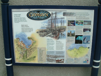
In the summer, I grumbled about how our new Town Centre maps were something of a disappointment. You can judge for yourself from this photo.
Rummaging through my disk drive to find it, I came across a photo of another town map, this time from a small fishing village in North Wales. Much more interesting, although it does have the benefit of a harbour and coastal history.
Friday, December 22, 2006
You are here...
Subscribe to:
Post Comments (Atom)


4 comments:
A long time ago... There used to be a nice map that had lights on it. It was either in Scatcherd Park or near the Town Hall.
Was it the sort that had a little pea lamp for "You are Here" and rows of buttons for showing up local features on the map?
I have a vague memory of these being quite common in the 60s in lots of places I visited in my childhood.
I think Scarborough and Whitley Bay had them. Possibly Newcastle Exhibition Park
It was exactly that sort of map.
I remember being fascinated by it as a small child. The lamps eventually faded and then stopped working.
It was somewhere near the town hall I think
Interestingly enough, Cllr Robert Finnigan mentioned these things at the Morley summit last week. It used to entertain him as a child, it seems.
I suspect my Nintendo DS loving nine year old would still be fascinated by such a map if he came across one.
Post a Comment